After an unforgettable 12-day car camping road trip through Redwoods National Park, Prairie Creek Redwoods State Park, Del Norte Coast Redwoods State Park, and Jedediah Smith Redwoods State Park. Below, I want to share my guide to the best hikes in Redwood National Park.
If you are curious about how I went about planning this adventure or want to learn more about the campgrounds of Redwoods National Park, please read my blog posts Redwoods National Park Campgrounds: Planning Guide and Guide to the Best Camping in Redwoods National Park.
Let’s dive in and get ready to discover the wonders of the Redwood State and National Parks together!
Things to Know Before Hiking Redwoods National Park
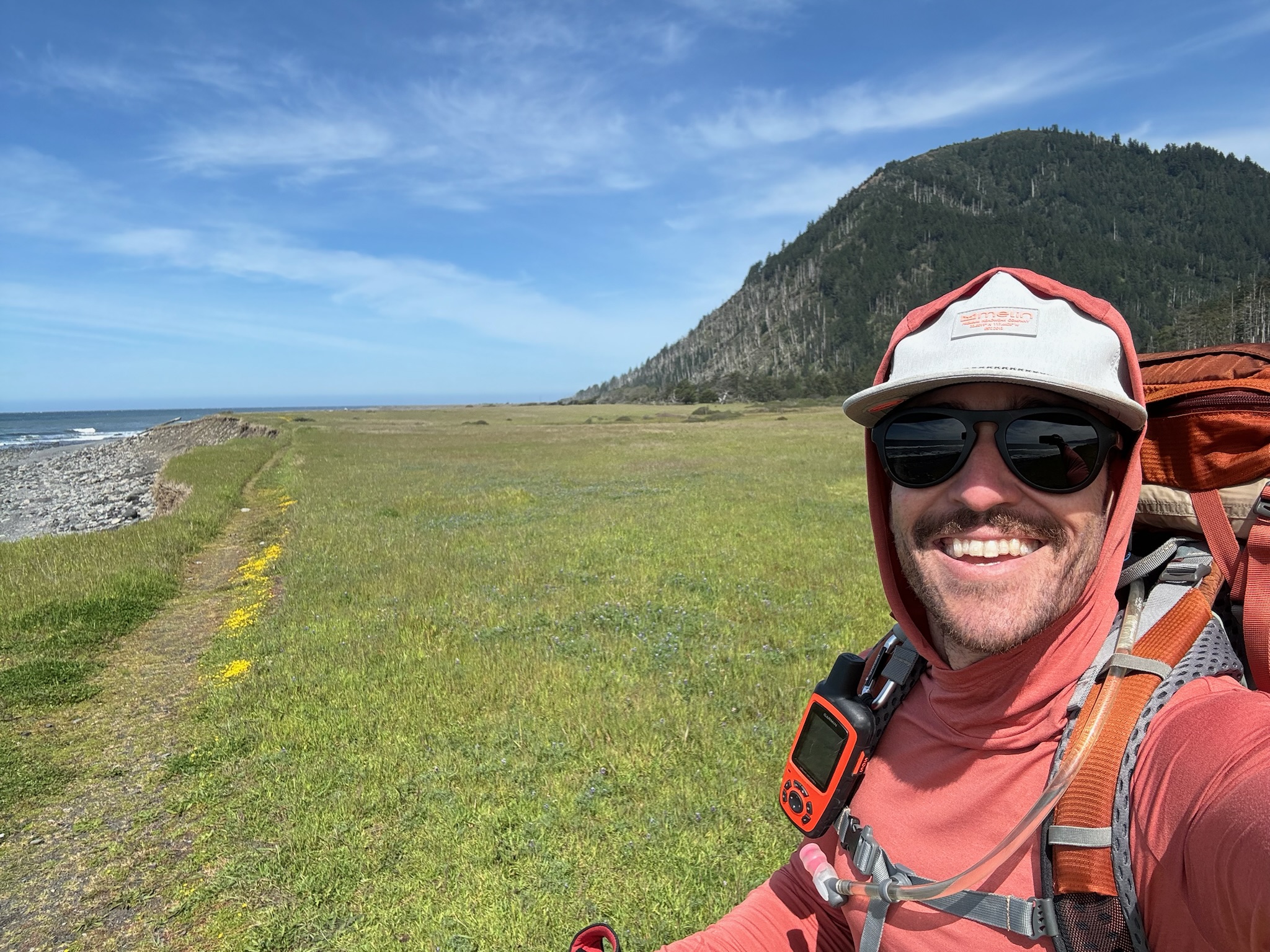
Open year-round, Redwood National Park and its state parks offer hikes for all levels of adventurers. Hikes can range from short, easy, and flat loops to longer hillier trails. One thing you’ll not have to battle in Redwoods National Park is the effects of altitude, total elevation ranges from 0 (sea level) to just under 3,200 ft. All the trails below were well-marked and easy to navigate, but it is always good practice to carry a map and since I was hiking alone, I also brought a GPS with maps of the area loaded and SOS calling functionality in case of emergency.
Remember to always check the weather forecast before hiking so you can hit the trails prepared. I was hiking Redwoods National Park in May so I knew there would be cooler mornings and a chance for fog to roll in during any one of my hikes. For any hike I knew would take me more than an hour, I packed a rain shell and a mid-layer just to be safe in case it got cooler or damp.
In the hike descriptions I have compiled below, I provide key attributes of the hikes like difficulty level, total distance, and elevation changes. Most of these attributes are taken from either the National Parks Service or the California State Parks Service. I am using these attributes because they consider the average visitor to the parks. If I used what I experienced it would skew the attributes towards my level and bias on difficulty. That said, depending on your level, you may find the hikes easier or harder than described or if you use a GPS, the distance and elevation change may be slightly different.
Now let’s dive in and review the best hikes in Redwood National Park.
Best Hikes in Redwoods National Park
Lady Bird Johnson Grove Trail
- Distance: 1.5 MI
- Difficulty: Easy
- Elevation Change: 100 ft
- Duration: 1 hour
- Trail Map & Google Map to Trailhead
This short walk in Redwoods National Park is a perfect easy hike for all ages. The trail is flat and well-maintained, making it accessible for many visitors. It’s a great introduction to the old-growth redwood forests of Northern California and a fitting tribute to the former first lady, Lady Bird Johnson, dedication to conserving these magnificent trees.
Tall Trees Grove Trail
- Distance: 3.8 MI
- Difficulty: Moderate
- Elevation Change: 800 ft
- Duration: 3 to 4 hours
- Trail Map & Google Map to Trailhead
Prepare for a moderately challenging but rewarding hike to see some of the largest trees in Redwoods National Park. The Tall Trees Grove Trail starts with a steep descent into the secluded grove, about 800 ft in elevation loss over 1.5 miles. Once in the grove, you can have a peaceful walk through the giants, including Libby Tree, which at one time was the tallest known Redwood. The grove also runs alongside Redwood Creek, where I stopped and enjoyed a snack while listening to the sounds of the creek. The loop through the grove is just under a mile and once complete, you hike back the same way you came down and ascend the 800 ft back to the trailhead.
Tall Tree Grove Trail requires an advanced permit which can be booked on the Redwoods Conservancy website up to 180 days in advance. The Permit is free and will be emailed to you 23 hours before your scheduled date. The park’s service only permits 50 parties a day for this trail, which limits the foot traffic and crowds on the trail. Here is more information on the permit process.
Another important piece for this hike is the trailhead is down a 7-mile dirt road. It seemed well maintained but it would be good to check ahead of time (ask a ranger at the visitors center) to make sure your car will be capable of making the drive.
Klamath River Overlook
- Distance: 1.0 MI
- Difficulty: Moderate
- Elevation Change: 350 ft
- Duration: 1 hour
- Trail Map & Google Map to Trailhead
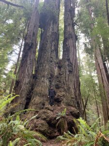
Short out-and-back trail, with an amazing vantage point of the coastline and the Klamath River mouth as it enters the Pacific Ocean. The trail is relatively steep which makes it more difficult than the mileage makes it seem. Well worth the stop if you’re driving by on the 101.
Yurok Loop Trail
- Distance: 1.25 MI
- Difficulty: Easy
- Elevation Change: 50 ft
- Duration: 1 hour
- Trail Map & Google Map to Trailhead
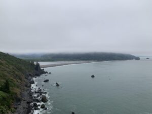
The Yurok Loop Trail, the trailhead located right off the 101, is an easy and picturesque 1-mile trail that offers stunning views over the Pacific Ocean. Ideal for families or a short nature break, it can be completed in under an hour. It’s a short hike with minimal elevation gain but offers a rewarding overlook.
Best Hikes in Prairie Creek Redwoods State Park
The Miner’s Ridge, James Irvine, Fern Canyon and California Coastal Trails Loop
- Distance: 12.1 MI
- Difficulty: Strenuous
- Elevation Change: 1,350 ft
- Duration: 6 to 7 hours
- Trail Map & Google Map to Trailhead
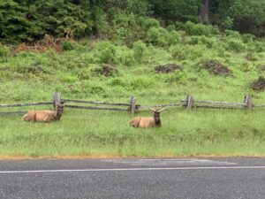
My Favorite hike from my adventure. This loop combines the full trails of Miners’ Ridge, James Irvine, and Fern Canyon Loop trails and a portion of the California Coastal Trail. This allows you to not have to repeat any portion of the trail for the majority of the 12 miles, the only exception is for a small portion from Prairie Creek Visitor Center to the James Irvine Trail and Miner’s Ridge Trail junction. This hike takes you through a variety of landscapes, including old-growth redwoods, a fern-lined canyon, a spruce forest, and the rugged Pacific Coastline. If you’re lucky or starting at the Prairie Creek Visitors Center, you may even spot the Roosevelt Elk
The loop can be accessed from the Prairie Creek Visitor Center, Gold Bluffs Beach Campground, or Fern Creek Day Use parking lot, all of which are located within Prairie Creek Redwoods State Park. For most, this will be at least a half-day of hiking, so pack plenty of water, snacks, and the appropriate clothing.
James Irvine Trail
- Distance: 9 MI
- Difficulty: Moderate to Strenuous
- Elevation Change: 1,200 ft
- Duration: 5 to 6 hours
- Trail Map & Google Map to Trailhead
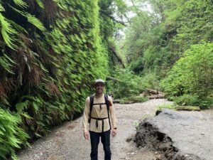
The James Irvine Trail is a beautiful and tranquil out-and-back hike taking you through old-growth Redwoods to the Pacific Ocean. While most start from either Prairie Creek Visitor Center, the trail can also be accessed from the Fern Canyon Day Use parking lot. Due to it passing right by the popular Fern Canyon Loop Trail, the James Irvine Trail is a more popular hike, especially for those seeking a little extra mileage while also seeing Fern Canyon. However, on my hike it never felt overcrowded and there were good stretches where I didn’t see anyone else. Adding the Fern Canyon loop would add about 0.5 MI to the hike, but it is well worth it! This hike is about a half-day adventure, so bring plenty of water and snacks.
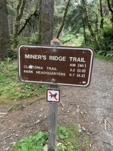
Miner’s Ridge Trail
- Distance: 9.2 MI
- Difficulty: Moderate to Strenuous
- Elevation Change: 1,400 ft
- Duration: 5 to 6 hours
- Trail Map & Google Map to Trailhead
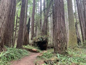
Miner’s Ridge Trail can be started from either Gold Bluffs Beach or the Prairie Creek Visitor Center. If you start from Gold Bluffs Beach, this hike can be cut a mile shorter if you turn around at the trail junction with James Irvine Trail. The hike will take you through a spruce forest, old-growth redwoods, and views of the rugged Pacific Coastline. The trail is a little less traveled than its adjacent hike, James Irvine Trail, because there is no direct access to the Fern Canyon Loop Trail. This allows for a more peaceful hike but allows you to still enjoy a diverse set of landscapes, offering an authentic Northern California hiking experience.
Fern Canyon Loop Trail
- Distance: 0.6 MI
- Difficulty: Easy
- Elevation Change: 150 ft
- Duration: 1 hour
- Trail Map & Google Map to Trailhead
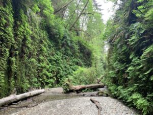
Fern Canyon Loop Trailhead* is accessible from the Fern Canyon Day use Parking Lot, within Prairie Creek Redwoods State Park. The Fern Canyon Loop Trail is a magical path that takes you through a narrow canyon lined with ancient ferns. Walking through Fern Canyon felt like a scene out of Jurassic Park (the number of times the words “Clever Girl” came to mind is embarrassing). This 1-mile loop is an easy hike with minimal elevation gain, making it accessible to most visitors to wander through and view canyon walls up to 50 feet high covered in lush green ferns. If there’s time after, you can also access the beach to the Pacific Ocean from the parking lot.
*To access the Fern Canyon Loop Trailhead from Fern Canyon Day use Parking Lot, you will need to apply for a free permit if going between May 15th to September 15th. During that period, if you start from the Prairie Creek Redwoods Visitor Center, you will not need a permit. For more information or to apply, please check out this National Parks Resource on the Fern Canyon Loop permit process.
California Coastal Trail
- Distance: 9.2 MI
- Difficulty: Moderate
- Elevation Change: 1,000 ft
- Duration: 6 hours
- Trail Map & Google Map to Trailhead
The Coastal Trail offers a scenic walk along the rugged California coastline on the Pacific Ocean. The park lists the total mileage available for the California Coastal Trail as 11.4 miles, which is the total for just one way. However, that does not account for having to access the trail from either Ossagon Trail (add 1.9 miles) or Skunk Cabbage Trail (add 4 miles). Plus, you need to double everything to do the full out and back. I personally only did about 2 miles of the trail as part of The Miners’ Ridge, James Irvine, Fern Canyon, and California Coastal Trails Loop, which I mentioned earlier. It was peaceful and a scenic way to round out the loop.
The hike I have outlined the trail which starts Ossagon Trail and goes to Fern Canyon Loop before starting the hike back. To me, this would be the ideal way to see a good portion of the California Coastal Trail (about 3 miles) and see Fern Canyon. Keep an eye out for Roosevelt elk along the way, as they can be spotted in the area. There are a few other ways to access this trail, from Gold Bluffs Beach and Fern Canyon Day Use parking lot, where you can hike small portions of the trail as out-and-backs and will experience little to no elevation change.
Cathedral Trees Trail
- Distance: 3 MI
- Difficulty: Easy
- Elevation Change: 250 ft
- Duration: 1-2 hours
- Trail Map & Google Map to Trailhead
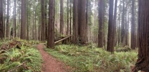
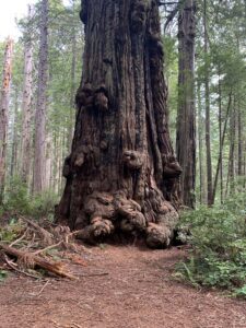
Starting from Prairie Creek Visitor Center, Cathedral Trees Trail is an easy out-and-back trail revered for its access to The Big Tree. With its 21-foot Diameter trunk, it is one of the largest Redwoods in Prairie Creek Redwoods State Park.
Cathedral Trees Trail is a more scenic way to get to The Big Tree as it is less crowded and has more Redwood coverage. Other ways to see The Big Tree are from the slightly easier Foothill trail, which runs parallel to Cathedral Trees Trail, or a short walk from a parking lot right by the giant tree (this option is ADA Accessible).
Hope Creek and Ten Tapyo Loop
- Distance: 3.6 MI
- Difficulty: Easy
- Elevation Change: 700 ft
- Duration: 2-3 hours
- Trail Map & Google Map to Trailhead
The trailhead to the Hope Creek and Ten Tapyo Loop is off Newton B. Drury Parkway in Prairie Creek Redwoods State Park. While this is a quieter trail, I didn’t see anyone on the trail until the last quarter mile of the trail, which starts in a redwood-lined canyon. The trail ascends to the top of the ridge which then meets up with an old dirt road, and depending on which way you started the loop, the dirt road will connect you to the other trail to finish the loop. I started by ascending the ridge on Hope Creek Trail, so the road led me to the Ten Tapyo trail. Along the Ten Tapyo trail, at the bottom of the canyon, there is a bridge that takes you over lush fern growth. There was a nice fog that settled in that gave this a real primal feel.
West Ridge Trail to Karl Knapp (formerly Prairie Creek) Trail Loop
- Distance: 5.8 MI
- Difficulty: Moderate
- Elevation Change: 750 ft
- Duration: 3 to 4 hours
- Trail Map & Google Map to Trailhead
This loop takes you through some of the lushest redwood scenery in Prairie Creek Redwoods National Park. The loop starts from the Prairie Creek Visitor Center, where you will take the main trail and follow it towards West Ridge and the James Irvine Trail.
The trail up to and along West Ridge Trail will be the toughest part as that’s where you gain all the elevation. 2.2 miles in you will come to Zig Zag #1 Trail, which you will take for 0.5 miles and descend back down to Karl Knapp Trail, formerly Prairie Creek Trail. The signage was hidden behind some overgrown ferns when I was there, so I missed the turn south on Karl Knapp. This caused me to head north for about a mile or so before realizing my mistake. The final 3.1 miles on Karl Knapp trail back to the visitors’ center is relatively flat and very scenic. This area was extremely lush and diverse, everything I envisioned when I dreamed of this area.
The whole trail was relatively quiet except for about a half mile within the visitors center on both the out and back. However, this area is worth the crowds so you can soak in its beauty.
Rhododendron Trail and Foothill Trail Loop
- Distance: 8.7 MI
- Difficulty: Moderate to Strenuous
- Elevation Change: 1,000 ft
- Duration: 4 to 5 hours
- Trail Map & Google Map to Trailhead
For anyone looking for a long loop that has a lot less foot track than West Ridge Trail to Karl Knapp (formerly Prairie Creek) Trail Loop, this is a good alternative. This trail also starts from the Prairie Creek Redwoods Visitors Center, but you cross to the East side of Newton B. Drury Parkway.
Initially, you follow part of Cathedral Tree Trail, and just under a mile into your journey, you will continue straight onto Rhododendron Trail. The first 2 miles of Rhododendron Trail, you hike most of the elevation you gain on the loop. Just after you reach the peak of the ridge, you will cross Cal Barrel Road, where the trail starts to open up. Enjoy the quiet descent amongst the big redwoods over the next 2.3 miles until you reach the junction to take a left onto Brown Creek Trail. The next mile, you will spend walking next to Brown Creek, until you reach Foothill. The Redwoods will start to get more impressive as you make it further along the Foothill trail, culminating at Big Tree.
Foothill Trail will run into Cathedral Tree Trail, which you can use to make your return to the visitors’ center.
Best Hikes in Del Norte Coast Redwoods State Park
Enderts Beach via California Coastal Trail
- Distance: 1.3 MI
- Difficulty: Easy
- Elevation Change: 175ft
- Duration: 5 to 1 hour
- Trail Map & Google Map to Trailhead
Starting at Last Chance Trailhead, just south of Crescent City, this trail follows the California Coastal Trail for about a half mile before turning down towards Nickel Creek Camp and Enderts Beach. The trail ends on a hill above the beach. With a little scrambling, the beach is accessible at lower tides. Retrace your steps back to the trailhead for the return journey.

Damnation Creek Trail
- Distance: 4 MI
- Difficulty: Moderate to Strenuous
- Elevation Change: 1,200 ft
- Duration: 3 to 4 hours
- Trail Map & Google Map to Trailhead
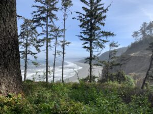
For a more challenging experience, Damnation Creek Trail in Del Norte Coast Redwoods State Park provides breathtaking coastal views after a vigorous hike through the redwoods. The challenge isn’t the distance but the elevation change over a short distance. As you leave the parking lot, you immediately find yourself amongst old-growth redwoods. If it’s early in the morning, you may even be spared the noise from the 101. About 0.7 miles in you will come to a bridge crossing the creek, after the bridge is when the descent starts. Over the next 1.1 miles, you will descend the majority of the 1,200 feet, down to the rugged Pacific Coastline. For most, the challenging part will be the return trip, where you need to ascend the 1,200 ft of elevation you just climbed down.
Currently, the trail from the bridge to the coastline is closed from Monday – Thursday each week as they repair the bridge after it sustained some damage in the winter storms of 2023. Please check the NPS Current Conditions page for updates on trail conditions.
Best Hikes in Jedidiah Smith Redwoods State Park
Boy Scout Tree Trail
- Distance: 5.6 MI
- Difficulty: Moderate
- Elevation Change: 750 ft
- Duration: 3 to 4 hours
- Trail Map & Google Map to Trailhead
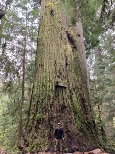
Located in Jedediah Smith Redwoods State Park, the Boy Scout Tree Trail is a favorite among visitors. This out-and-back trail allows you to marvel at a canopy of old-growth redwoods and fern-covered forest floor. Just under 2.5 miles in you will see the turn for the trail’s namesake, the impressive Boy Scout Tree. It said the tree was given this name because a Boy Scout troop leader discovered the tree. From the Boy Scout Tree junction, the trail continues about another 0.5 mile until its culmination at Fern Falls. I saved my visit to the Boy Scout Tree until the “back” portion of the hike. At its base I had a snack while admiring the tallest tree, at the time, I had ever seen. It’s hard to comprehend the sheer size and age of this tree.
The drive to the trailhead is a little adventure of its own, a drive down a single-lane dirt road surrounded by old-growth redwoods. When I was there, the road was in good condition and easy to navigate. Parking can be tough later in the day, as it is mostly available through turnouts on the roadside. Therefore, I’d suggest getting on the trail early to secure a spot.
The Grove of Titans
- Distance: 1.7 MI
- Difficulty: Easy
- Elevation Change: 150 ft
- Duration: 1 to 2 hours
- Trail Map & Google Map to Trailhead
Just down the road from Boy Scout Tree Trail, Grove of Titans is another popular hike in Jedidiah Smith Redwoods State Park. Due to the heavy foot traffic, the park opened an elevated walkway through the grove in 2021 to help fight erosion. By keeping the ground cover intact to preserve the redwood’s ecosystem. The old-growth redwood trees in the grove are some of the world’s largest by total volume, making them a must-see if you are in the area. Parking can be tough later in the day, as it is mostly available through turnouts on the roadside. I’d suggest getting on the trail early to secure a spot.
Stout Memorial Grove Trail
- Distance: 0.5 MI
- Difficulty: Easy
- Elevation Change: 30 ft
- Duration: < 1 hour
- Trail Map & Google Map to Trailhead
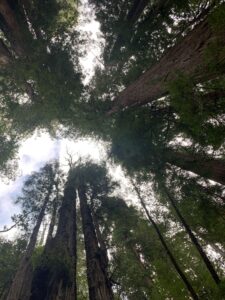
In Jedediah Smith Redwoods State Park, Stout Memorial Grove Trail is a tranquil short walk, that offers a peaceful retreat among old-growth redwoods. With an elevation gain of only about 30 feet, it makes it accessible for all levels. This grove is perfect for those looking for a quick connection with the old-growth redwood forests without a strenuous hike.
Final Thoughts on the Best Hikes in Redwood National Park
With its lush ferns, the ancient old-growth redwoods (the tallest trees in the world), the Pacific Coastline, and its relatively low foot traffic (at least compared to other popular National Parks), Redwood National Park is on my list of must-visit! While it’s not easy to get to, it is worth the extra effort.
Remember to prepare in advance and follow the park rules to help keep these parks clean and enjoyable.
Happy hiking!

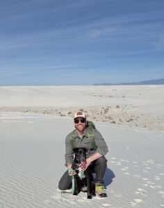
Hi, I’m Dave — a laid-back adventure enthusiast based in Southern California with a deep love for the outdoors and all the unexpected joys it brings. Through Plan | Pack | Discover, I share my passion for hiking, camping, surfing, and backpacking — and help you get ready for your own adventures, too.
More about me and Plan | Pack | Discover

